Lahıc (Lahıc)
Lahıc (Tat: Löhij) is a village and municipality on the southern slopes of Greater Caucasus within the Ismailli Rayon of Azerbaijan. Population is approximately 860 people who speak the Tat language, also known as Tati Persian, a Southwestern Iranian language spoken by the Tats of Azerbaijan and Russia.
Lahij is a notable place in Azerbaijan, with its authentic handicrafts traditions, particularly related to copper. The village's carpet and rug crafts are also well known in Azerbaijan and the South Caucasus. Lahij has an old sewage system (some experts claim that it was built 1000–1500 years ago). Due to frequent earthquakes local people have developed sophisticated and authentic construction techniques.
Lahij is one of the most ancient human settlements in Azerbaijan. The Lahij District is located in the Ismayilli region of the Republic of Azerbaijan, on the southern slopes of the Greater Caucasus Mountain Range at a height of 1211 meters above sea level.
During the Medieval Period, Lahij became an important centre of craftsmen in Azerbaijan. Lahij master craftsmen could create forty types of items related to Folk Art. These skilled craftsmen included jewelers, blacksmiths, carpenters, carpet makers, engravers, painters, tanners, shoemakers and bast shoe makers, sock weavers and others. Many valuable examples of the products of these skills are exhibited in famous museums and collections.
Map - Lahıc (Lahıc)
Map
Country - Azerbaijan
 |
 |
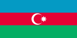
| Flag of Azerbaijan | |
The Azerbaijan Democratic Republic proclaimed its independence from the Transcaucasian Democratic Federative Republic in 1918 and became the first secular democratic Muslim-majority state. In 1920, the country was incorporated into the Soviet Union as the Azerbaijan SSR. The modern Republic of Azerbaijan proclaimed its independence on 30 August 1991, shortly before the dissolution of the Soviet Union in the same year. In September 1991, the ethnic Armenian majority of the Nagorno-Karabakh region formed the self-proclaimed Republic of Artsakh. The region and seven surrounding districts are internationally recognized as part of Azerbaijan pending a solution to the status of the Nagorno-Karabakh through negotiations facilitated by the OSCE, although became de facto independent with the end of the First Nagorno-Karabakh War in 1994. Following the Second Nagorno-Karabakh War in 2020, the seven districts and parts of Nagorno-Karabakh were returned to Azerbaijani control.
Currency / Language
| ISO | Currency | Symbol | Significant figures |
|---|---|---|---|
| AZN | Azerbaijani manat | ₼ | 2 |
| ISO | Language |
|---|---|
| HY | Armenian language |
| AZ | Azerbaijani language |
| RU | Russian language |


